


Salkantay Trek: Route, Altitude and Difficulty, Day by Day
The Salkantay trek is a 4 to 5 day hike of about 45 miles (72 km) from Soraypampa over the 15,190 ft (4,630 m) Salkantay Pass, down through cloud forest to Aguas Calientes and Machu Picchu. No Inca Trail permit is needed, it runs all year, and altitude is the hard part.

In this guide
Short answer: The Salkantay trek is a 4 to 5 day hike of about 45 miles (72 km) from Soraypampa, below Salkantay mountain, over a 15,190 ft (4,630 m) pass and down through cloud forest to Aguas Calientes and Machu Picchu. It needs no Inca Trail permit, runs all year, and is harder than the Inca Trail because of the altitude.
Where the Salkantay Route Goes
The classic Salkantay route starts at Soraypampa, about 12,800 ft (3,900 m), three to four hours by road from Cusco through Mollepata. It climbs to the Salkantay Pass at 15,190 ft (4,630 m), drops into the Santa Teresa valley, crosses the ridge at Llactapata and ends at Hidroeléctrica, where you follow the railway to Aguas Calientes. Salkantay mountain itself rises to 20,574 ft (6,271 m), per its Wikipedia entry, and you walk right under its glacier.
| Day | Stop | Altitude (ft) | Altitude (m) | Distance that day (mi and km) | Walking time |
|---|---|---|---|---|---|
| 1 | Soraypampa camp | 12,800 | 3,900 | 7.5 mi (12 km) with Humantay Lake | 5 to 6 hours |
| 1 | Humantay Lake (side trip) | 13,780 | 4,200 | included above | included above |
| 2 | Salkantay Pass | 15,190 | 4,630 | 13.7 mi (22 km) | 8 to 9 hours |
| 2 | Chaullay | 9,510 | 2,900 | end of day 2 | |
| 3 | Lucmabamba, coffee farms | below 9,510 | below 2,900 | 10 mi (16 km) | 5 to 6 hours |
| 4 | Llactapata ruins | 9,190 | 2,800 | 11 mi (18 km) to Aguas Calientes | 6 to 7 hours |
| 4 | Aguas Calientes | 6,690 | 2,040 | end of day 4 | |
| 5 | Machu Picchu | 7,970 | 2,430 | bus up, guided visit | 2 to 3 hours inside |
Think of the profile as one big tent. Day 1 is a short climb, day 2 goes up 2,400 ft (730 m) to the pass and then down about 5,680 ft (1,730 m), and days 3 and 4 are mostly warm valley walking with one last climb to Llactapata. The table below uses the altitudes and distances of our own 5-day itinerary.
The Salkantay Itinerary in Five Days
The standard Salkantay trek takes 5 days and 4 nights: four hiking days and a fifth day at Machu Picchu. Shorter 4-day versions exist and skip a night by walking farther or riding part of the way. Here is how the 5-day version feels on the ground.
Day 1: Cusco to Soraypampa and Humantay Lake
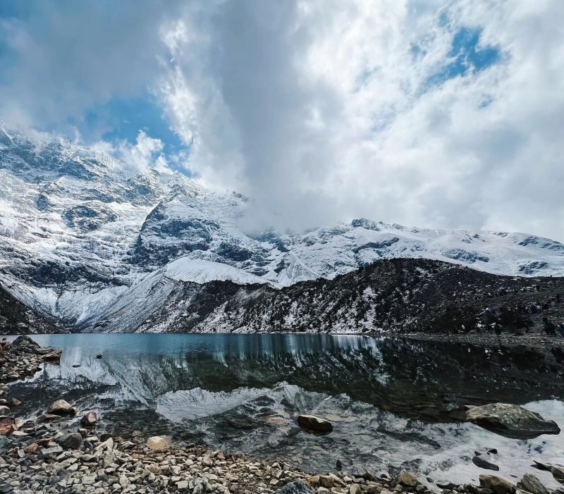
Pickup is before dawn. You drive through Mollepata to Soraypampa, where the camp sits in a cold, open meadow with the Salkantay glacier straight ahead. In the afternoon most groups climb to Humantay Lake at 13,780 ft (4,200 m), a turquoise lake under a hanging glacier. Count about 7.5 miles (12 km) for the day. The climb to the lake is steep and short, and it works as a test of how your lungs handle the altitude before the real pass.
Day 2: Over the Salkantay Pass to Chaullay
The hard day. You leave in the dark and zigzag up to the pass at 15,190 ft (4,630 m). At that height each breath carries roughly 40 percent less oxygen than at sea level, and most people stop every few switchbacks. Then comes the long descent to Chaullay, around 9,510 ft (2,900 m). The total is about 13.7 miles (22 km) and 8 to 9 hours on foot. Your knees will feel the downhill more than your lungs felt the climb.
Day 3: Down the Santa Teresa Valley
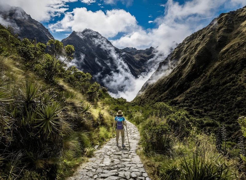
About 10 miles (16 km) through cloud forest, waterfalls and bamboo to La Playa and on to Lucmabamba, in coffee country. The air turns warm and humid, around 75°F (24°C) by midday. Pack sunscreen and bug spray, because the sand flies at Lucmabamba bite hard and the itch lasts days.
Day 4: Llactapata to Aguas Calientes
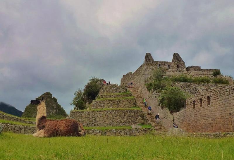
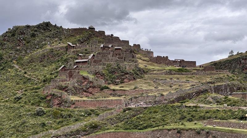
An old Inca path climbs to Llactapata, about 9,190 ft (2,800 m), where you see Machu Picchu across the valley for the first time. It is a small ruin with very few visitors. You then drop to Hidroeléctrica and follow the railway to Aguas Calientes, 6,690 ft (2,040 m), about 11 miles (18 km) for the day. A shower and a real bed wait at the end.
Day 5: Machu Picchu and the Train Back
You ride the bus up to the citadel at 7,970 ft (2,430 m) for a guided visit, then take the train toward Ollantaytambo and a van to Cusco. The train allows one backpack of up to 8 kg (17.6 lb) and 100 cm in combined height, length and width, or one carry-on of up to 12 kg (26.5 lb) and 115 cm, per PeruRail. Leave your big suitcase in Cusco.
Salkantay Trek Difficulty
The Salkantay trek is a demanding hike for fit walkers, and the altitude is what makes it hard, more than the distance. You sleep at 12,800 ft (3,900 m) on night 1 and cross 15,190 ft (4,630 m) the next morning. The US CDC says unacclimatized travelers who sleep at 8,000 ft (2,450 m) or higher are at risk of altitude illness, and it advises against going straight to a sleeping altitude above 9,000 ft (2,750 m) in a single day.
That is why we ask for at least two nights in Cusco, which sits around 11,150 ft (3,400 m), before the trek starts. Three is better. The mistake we see every season is people flying in from Lima and starting Salkantay the next morning. They usually make it, but the pass becomes a miserable crawl with a pounding headache. Read our Cusco altitude and acclimatization guide before you book flights, and talk to your doctor about acetazolamide, which the CDC lists as a preventive medicine for altitude illness.
Fitness matters too. If you can hike 6 hours with hills on a weekend at home and feel fine the next day, you are ready. Train on downhills as well. The 5,680 ft (1,730 m) descent on day 2 is where knees and toenails suffer, and trekking poles make a real difference.
Weather and Cold on the Salkantay
The Salkantay trek crosses two climates in two days: freezing nights at Soraypampa and humid, warm afternoons in the cloud forest. The dry season, May to September, gives clear skies and the coldest nights, with frost on the tents in June and July. SENAMHI, Peru's weather service, puts the Andean rainy season between September and April, with the heaviest rain from December to March, when snow or mud can close the pass for a day or more.
| Months | Season | Trail conditions | Our take |
|---|---|---|---|
| May | Dry | Clear skies, cold nights, green valleys | Top pick |
| June to August | Dry | Clearest views, frost at Soraypampa, busiest | Good if you pack warm |
| September | Dry, end of season | Clear mornings, first clouds late in the month | Top pick |
| October and November | Rains starting | Afternoon showers, muddy patches | Fine with a rain shell |
| December to March | Heaviest rain | Pass closures after snow, deep mud on the descent | Only with flexible dates |
| April | Rains ending | Wet trail early, clearing late | Good second choice |
Our pick is May or September. You get the dry trail without the deepest cold of June and July, and fewer groups at camp. April and October are good second choices if you accept some afternoon showers. Avoid January and February unless you have flexible dates and a good rain shell.
Pack for both ends of the thermometer. A down jacket, warm hat, gloves and a sleeping bag rated to about 14°F (minus 10°C) for the first two nights, then T-shirt, shorts, sun hat and insect repellent for days 3 and 4. People pack for the glacier and forget the jungle, or the other way around.
Lodges or Camping on the Trail
Salkantay trips sleep in one of three ways: tents, fixed camps with domes or huts, or full mountain lodges. Most groups, ours included, camp at Soraypampa and use a camp or simple lodge at Chaullay and Lucmabamba, then sleep in a hotel in Aguas Calientes on the last night. The cook and the mules carry the kitchen and your duffel, so you hike with a daypack only.
Some operators set up permanent glass-roofed domes at Soraypampa, which are warmer than a tent and let you watch the stars from bed. A few high-end trips run lodge to lodge with heated rooms and hot tubs, at several times the price. Domes and lodges change the comfort of night 1, which is the coldest. They do not change the pass.
Our advice: camping is fine if your sleeping bag is warm enough. The cold night at Soraypampa is short, and dinner in the mess tent with hot soup and tea makes it easy. Spend the extra money on acclimatization days in Cusco, not on a heated room.
Guided Trek or Hiking Alone
You can hike the standard Salkantay route without a guide, because it is not part of the permit system that controls the Inca Trail. The trail is clear in the dry season and there are small family-run camps along the way. You pay a community trail fee at Mollepata, about S/20 (as of 2025, per trekking sources, not an official page).
Going alone means you carry your own tent, stove and food over the pass, or you rent mules locally, and you solve the Machu Picchu ticket, the bus and the train back yourself. In the rainy months or with any sign of altitude illness, being alone above 13,000 ft is a real risk. A guided group brings a cook, mules, emergency oxygen, someone who has seen altitude sickness a hundred times, and the Machu Picchu ticket already in your name.
If you want that, our Salkantay Trek 5 days to Machu Picchu includes the guide, cook, mules, three nights of camping, the hotel night in Aguas Calientes and a Circuit 2 entrance. If you would rather compare routes first, see all our treks from Cusco.
The Salkantay Variant That Needs a Permit
One version of the Salkantay does need a permit. The Inca Trail regulation of SERNANP and the Ministerio de Cultura lists a 6-day route (Ruta 03) from Soraypampa over the high pass of Inkachiriaska to Pampacahuana and Paucarcancha, where it joins the Inca Trail at Wayllabamba and reaches Machu Picchu by Wiñay Wayna. Because it enters the Red de Caminos Inka, it follows the same rules as the Inca Trail: booking only through a licensed operator, a daily cap, and closure every February. Our guide to Inca Trail permits explains how that system works.
Salkantay vs Inca Trail
The Salkantay trek is higher, longer and wilder than the Classic Inca Trail. The Inca Trail has more ruins, stone steps the whole way and an arrival on foot through the Sun Gate. Pick the Inca Trail if Inca sites matter most and you can book months ahead. Pick Salkantay if you want glaciers and a big pass, if your knees hate stairs, or if the Inca Trail permits are gone.
| Salkantay trek (5 days) | Classic Inca Trail (4 days) | |
|---|---|---|
| Distance | about 45 mi (72 km) | about 26 mi (43 km) |
| High point | Salkantay Pass, 15,190 ft (4,630 m) | Dead Woman's Pass, 13,830 ft (4,215 m) |
| Permit | Not needed on the standard route | Required, sold only through licensed operators |
| Daily cap | None on the standard route | 500 people a day including staff |
| February | Open | Closed for maintenance |
| Trail surface | Dirt paths and old mule tracks | Original Inca stone steps |
| Ruins on the way | Llactapata | Runkurakay, Sayacmarca, Phuyupatamarca, Wiñay Wayna |
| Arrival at Machu Picchu | From Aguas Calientes by bus | Walking in through Intipunku (Sun Gate) |
| Nights | 3 camping, 1 hotel | 3 camping |
The table shows the numbers side by side. For the longer comparison, read Salkantay or Inca Trail, which one to hike.
Questions people ask
How hard is the Salkantay trek?
Hard, mostly because of altitude. Night 1 is at 12,800 ft (3,900 m) and cross a 15,190 ft (4,630 m) pass on day 2, which takes 8 to 9 hours with a long descent. Fit hikers who give Cusco two or three nights first finish without trouble. People who arrive the day before suffer on the pass.
How cold does it get on the Salkantay trek?
Below freezing at Soraypampa and on the pass, especially in June and July, when the tents are often white with frost at dawn. By day 3 you are in the cloud forest at around 75°F (24°C) and humid. Carry a sleeping bag good to about 14°F (minus 10°C), a down jacket and gloves, plus light clothes for the warm days.
Can you do the Salkantay trek without a guide?
Yes. The standard route from Soraypampa to Santa Teresa is outside the Inca Trail permit system, so the law does not require a guide. Expect a small community fee at Mollepata, and plan to handle your own gear, food, Machu Picchu ticket and train. The 6-day variant that joins the Inca Trail is different and needs a licensed operator.
Do you need to book the Salkantay trek in advance?
The trail itself has no quota, so a guided group can often be found a few weeks out. What sells out is the Machu Picchu entrance and the train back, mainly from May to August. For the dry season, book two to three months ahead so your ticket and train are secured for the right day.
How long is the Salkantay trek?
About 45 miles (72 km) over four hiking days on the classic 5-day itinerary, and the last day is the citadel visit. Daily stretches run about 7.5, 13.7, 10 and 11 miles (12, 22, 16 and 18 km). Shorter 4-day versions cover the same ground with longer days or a vehicle on one stretch.
Do you need a permit for the Salkantay trek?
No permit is needed for the standard Salkantay route, and it stays open all year, including February. You only need a Machu Picchu entrance ticket for the last day. The exception is the 6-day route that crosses into the Inca Trail at Wayllabamba, which uses Inca Trail permits sold only through licensed operators.
Sources
- US CDC Yellow Book, High-Altitude Travel and Altitude Illness checked October 2026
- Reglamento de Uso Turístico Sostenible de la Red de Caminos Inka del SHM (SERNANP and DDC Cusco), Anexo D routes checked October 2026
- DDC Cusco, 2026 Red de Caminos Inka sales and daily spaces checked October 2026
- DDC Cusco, February closure of the Red de Caminos Inka checked October 2026
- SENAMHI, rainy season outlook (September to April) checked October 2026
- PeruRail luggage policy checked October 2026
- Ministerio de Cultura, Machu Picchu online tickets checked September 2026
- Wikipedia, Salkantay (mountain height) checked October 2026
- Salkantay.org, permits and trail fee checked October 2026
This guide was last reviewed in October 2026. Prices, rules and timetables are quoted with the date we checked them.