


The Inca Trail Day by Day: Map, Distance and Difficulty
The Classic Inca Trail runs about 26 mi (43 km) from KM 82 near Ollantaytambo to the Sun Gate above Machu Picchu, walked in 4 days with 3 nights in tents. The high point is Dead Woman's Pass at 13,829 ft (4,215 m) on day 2. The stairs and the altitude make it hard, not the distance.

In this guide
Short answer: The Classic Inca Trail is about 26 mi (43 km) of Inca stone road from KM 82 of the railway near Ollantaytambo to the Sun Gate (Intipunku) above Machu Picchu, walked in 4 days with 3 nights in tents. The high point is Dead Woman's Pass (Warmiwañusca) at 13,829 ft (4,215 m) on day 2. It is hard because of thousands of stone steps and the thin air, not because of the mileage. You need a permit, bought months ahead through a licensed operator, and a guide.
Where the Inca Trail runs
Picture the Urubamba River flowing northwest from Ollantaytambo toward Machu Picchu, with the railway beside it. The trail starts at a footbridge over the river at KM 82, the railway's 82nd kilometer from Cusco, at about 8,530 ft (2,600 m). It leaves the river almost at once, climbs south up the Cusichaca valley, turns west over Dead Woman's Pass, drops into the Pacaymayo valley, crosses a second pass at Runkurakay and a third near Phuyupatamarca, then descends through cloud forest to Wiñay Wayna. From there it contours above the river to the Sun Gate and drops into Machu Picchu. You end about 6 mi (10 km) as the crow flies from where you started, having climbed and descended more than 2 vertical mi (3,500 m) in total.
The road itself is part of the Qhapaq Ñan, the Inca road system inscribed on UNESCO's World Heritage list in 2014, and it runs inside the Historic Sanctuary of Machu Picchu. Five Inca sites sit on it and nowhere else by road: Llactapata (also written Patallacta), Runkurakay, Sayacmarca, Phuyupatamarca and Wiñay Wayna. The elevation profile below shows why day 2 gets all the attention: one long climb of about 3,990 ft (1,215 m), then down, then two smaller passes on day 3, then a long descent to the finish.
The short version of the trail starts at KM 104, lower down the railway, and joins the classic route at Wiñay Wayna. It is about 7.5 mi (12 km) in one day, with a hotel night in Aguas Calientes instead of tents.
Day by day in numbers
The table below gives each day's distance, high point, campsite and walking time. Treat the kilometers as approximate: the Ministerio de Cultura does not publish day-by-day distances, every operator splits the days a little differently, and the campsites you get depend on the permit.
| Day | From | To | Distance (mi / km) | High point (ft / m) | Sleep (ft / m) | Walking time |
|---|---|---|---|---|---|---|
| 1 | KM 82, 8,530 ft (2,600 m) | Wayllabamba | 7.5 / 12 | 9,840 / 3,000 | 9,840 / 3,000 (tent) | 5 to 6 |
| 2 | Wayllabamba | Pacaymayo | 7 / 11 | 13,829 / 4,215 (Dead Woman's Pass) | 11,810 / 3,600 (tent) | 7 to 8 |
| 3 | Pacaymayo | Wiñay Wayna | 9.5 / 15 | 12,960 / 3,950 (Runkurakay pass) | 8,690 / 2,650 (tent) | about 8 |
| 4 | Wiñay Wayna | Sun Gate and Machu Picchu | 3 / 5 | 8,920 / 2,720 (Sun Gate) | Cusco, 11,150 / 3,400 (hotel not included) | 1.5 to the gate, then 2 to 3 inside Machu Picchu |
Day 1: KM 82 to Wayllabamba
About 7.5 mi (12 km) and 5 to 6 hours, from 8,530 ft (2,600 m) to the camp at Wayllabamba at about 9,840 ft (3,000 m). A dusty path along the river, a look down on the terraces of Llactapata, then a gentle climb up the Cusichaca valley. People call it the easy day and then wonder why their legs feel it. The reason is the start: pickup in Cusco at 4:30 a.m. and three hours in a van before the first step.
Day 2: Wayllabamba to Pacaymayo over Dead Woman's Pass
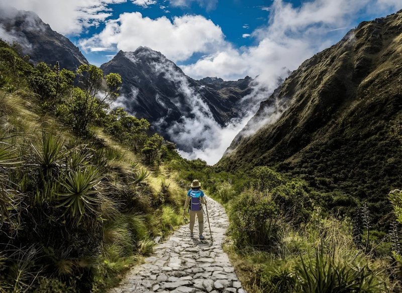
About 7 mi (11 km) and 7 to 8 hours. The climb of about 3,990 ft (1,215 m) to Dead Woman's Pass at 13,829 ft (4,215 m) is the whole morning, on stone steps through polylepis forest and then open grass. On the last switchbacks most people stop every twenty steps, and that pace gets you there. The descent to the camp at Pacaymayo, about 11,810 ft (3,600 m), is roughly 2,020 ft (615 m) of steep steps, and it hurts knees more than the climb hurt lungs.
Day 3: Pacaymayo to Wiñay Wayna
About 9.5 mi (15 km) and about 8 hours, the longest day and the one guides love. A climb of about 1,150 ft (350 m) past the round ruin of Runkurakay to the second pass at roughly 12,960 ft (3,950 m), the walled site of Sayacmarca on its rock spur, original Inca paving and a tunnel through cloud forest, the ritual baths of Phuyupatamarca near the third pass at about 12,000 ft (3,650 m), and then a staircase that drops more than 4,000 ft (about 1,300 m) to the camp near the Wiñay Wayna terraces at about 8,690 ft (2,650 m).
Day 4: Wiñay Wayna to the Sun Gate and Machu Picchu
About 3 mi (5 km) and 1.5 hours of contouring trail, then a short flight of steep steps to the Sun Gate at about 8,920 ft (2,720 m). Machu Picchu appears below at 7,970 ft (2,430 m), with Huayna Picchu behind it. You walk down into the site for a guided visit of two to three hours, then take the bus to Aguas Calientes, the train to Ollantaytambo and a van to Cusco.
How hard the Inca Trail is, honestly
The Inca Trail is a hard hike for a fit person and a very hard one for someone who does not train. Four things make it so, and distance is not one of them. A fit walker covers 26 mi over four days at home without thinking about it.
First, altitude. You sleep at about 9,840 ft (3,000 m) and 11,810 ft (3,600 m), and the CDC puts any unacclimatized traveler at risk of altitude illness at sleeping altitudes of 8,000 ft (2,450 m) or higher. The pass is higher than any summit in the lower 48 states except the Colorado and California fourteeners. The fix is time: two or three nights in Cusco at 11,150 ft (3,400 m) before the trail, with the guided city tour and a Sacred Valley day as the easy outings. Ask your doctor about acetazolamide before you fly. The CDC recommends it for travelers at medium and high risk, started the day before the ascent, and it is not something to decide at a trailhead.
Second, the stairs. Days 2 and 3 are thousands of uneven stone steps, up and then down. Flat trail miles do not prepare you for them. Train on stairs or steep hills with a daypack, and bring trekking poles with rubber tips, which the sanctuary rules require to protect the paving.
Third, the long days. Day 2 is 7 to 8 hours and day 3 about 8 hours of walking, with a 5:30 a.m. wake-up and a 3:30 a.m. one on the last morning. Fourth, the camping. Three nights in a tent, basic toilets, no showers, and nights near freezing at Pacaymayo from June to August. The crew carries the tents, food and your duffel, so you walk with a daypack, but you still sleep on the ground at 11,800 ft.
Who should book it: anyone who can climb 3,000 ft of stairs with a light pack in a morning and sleep in a tent without misery. Who should not: anyone who arrived in Cusco yesterday, anyone with knee trouble that stairs make worse, and anyone who needs a bed. Our Salkantay trek guide describes the higher but gentler alternative on dirt paths, and the Salkantay vs Inca Trail comparison puts the two side by side.
Permits decide whether you walk at all. The Ministerio de Cultura issues 500 spaces a day for the classic routes, counting guides, cooks and porters, by name and passport number, and the trail closes every February. The high season sells out months ahead, which our Inca Trail permits guide explains month by month. If you are ready, book the 4-day Inca Trail with the permit, guide, cook, porters and camping included, from US$797 per person.
Inca Trail packing list
The crew carries a duffel for you with your sleeping bag and clothes, and the porters' loads are capped by law, so your duffel allowance is small, about 11 to 15 lb (5 to 7 kg). You carry everything else in a daypack. Pack for four climates in four days: cold dawns, hot sun at the pass, humid cloud forest and rain in any month.
- Broken-in hiking boots with ankle support, plus camp sandals.
- Trekking poles with rubber tips (required on the trail).
- Daypack of 20 to 30 liters with a rain cover, and 2 liters of water capacity.
- Rain shell and rain pants, since showers come even in the dry season.
- Warm layer for camp (down or fleece), hat and gloves for the pass and the 3:30 a.m. start.
- Sleeping bag rated for freezing nights, your own or rented, plus a liner.
- Headlamp with fresh batteries.
- Sun hat, sunglasses, sunscreen and lip balm: the sun at 13,000 ft burns fast.
- Insect repellent for Wiñay Wayna and Machu Picchu, where sand flies bite.
- The passport you booked with. It is checked at KM 82 and at Machu Picchu, and the permit cannot be renamed.
- Cash in soles for tips, snacks, the toilets and lunch in Aguas Calientes.
- Toilet paper, hand sanitizer, a small quick-dry towel, blister pads and your own medication.
- Snacks you like, and a small bag for your trash: nothing stays on the trail.
Leave the suitcase at your Cusco hotel. The return train allows one backpack of up to 8 kg (17.6 lb) and 100 cm, or a hand bag of up to 12 kg (26.5 lb) and 115 cm, per PeruRail's luggage rules, and the duffel counts.
| Fact | Value | Source |
|---|---|---|
| Distance | about 26 mi (43 km), KM 82 to the Sun Gate | |
| Days and nights | 4 days, 3 nights in tents | en.wikipedia.org |
| Start | KM 82 (Piskacucho), about 8,530 ft (2,600 m), near Ollantaytambo | en.wikipedia.org |
| Highest point | Dead Woman's Pass (Warmiwañusca), 13,829 ft (4,215 m), day 2 | en.wikipedia.org |
| Other passes | Runkurakay about 12,960 ft (3,950 m) and Phuyupatamarca about 12,000 ft (3,650 m), day 3 | en.wikipedia.org |
| Campsites | Wayllabamba about 9,840 ft (3,000 m), Pacaymayo about 11,810 ft (3,600 m), Wiñay Wayna about 8,690 ft (2,650 m) | |
| Finish | Sun Gate about 8,920 ft (2,720 m), Machu Picchu 7,970 ft (2,430 m) | tuboleto.cultura.pe |
| Permits | 500 a day including staff, by name and passport, sold through licensed operators | culturacusco.gob.pe |
| Closure | every February | faolex.fao.org |
| Heritage | Qhapaq Ñan, Andean Road System, UNESCO World Heritage since 2014 | whc.unesco.org |
| Our 4-day trek | US$797 per person, permit, guide, cook, porters and camping |
Sources
- Inca Trail to Machu Picchu, Wikipedia (length, starting points, passes, sites, permits, February closure)
- Reglamento de Uso Turístico Sostenible de la Red de Caminos Inka (SERNANP and Ministerio de Cultura): routes, capacity, guides, closure
- Dirección Desconcentrada de Cultura Cusco, sale of Inca Trail spaces (500 per day)
- UNESCO, Qhapaq Ñan, Andean Road System (inscribed 2014)
- CDC Yellow Book, High Altitude Travel and Altitude Illness
- PeruRail, luggage rules
Questions people ask
How long is the Inca Trail?
The Classic Inca Trail is about 26 mi (43 km) from KM 82 of the railway to the Sun Gate at Machu Picchu, walked in 4 days: roughly 7.5, 7, 9.5 and 3 mi (12, 11, 15 and 5 km). The Short Inca Trail from KM 104 covers the last 7.5 mi (12 km) in one day and sleeps in a hotel.
How hard is the Inca Trail?
Hard for a fit hiker, very hard without training. The difficulty is altitude (you sleep at 9,840 and 11,810 ft and cross 13,829 ft) and thousands of stone steps on days 2 and 3, not the distance. Spend two or three nights in Cusco first, train on stairs, and bring poles. Porters carry the camp and your duffel.
Where does the Inca Trail start?
At KM 82 of the Cusco to Machu Picchu railway, a checkpoint called Piskacucho on the Urubamba River near Ollantaytambo, at about 8,530 ft (2,600 m). Tours drive there from Cusco in about three hours. Some operators start at KM 88, and the 2-day version starts at KM 104.
How high is Dead Woman's Pass?
Dead Woman's Pass (Warmiwañusca) is 13,829 ft (4,215 m), the highest point of the Inca Trail, crossed on the morning of day 2 after a climb of about 3,990 ft (1,215 m) from Wayllabamba. The name comes from the shape of the ridge, which looks like a woman lying on her back.
Do you need a guide for the Inca Trail?
Yes. The sanctuary rules allow the trail only through licensed operators with an official guide, and permits are issued by name and passport number through those operators. There is no way to buy a permit yourself or walk the classic route alone. Our 4-day trek includes the permit, guide, cook and porters.
Can you hike the Inca Trail in 2 days?
Yes, on the Short Inca Trail from KM 104: about 7.5 mi (12 km) in one day past Wiñay Wayna to the Sun Gate, a hotel night in Aguas Calientes, and a guided Machu Picchu visit the next morning. It needs its own permit (250 a day on that route) and has no camping.
What is the best month for the Inca Trail?
May to September is the dry season, with clear days, cold nights and the most hikers. April and October are greener with some showers and easier permits. The trail closes every February, and December to March bring daily rain and mud. If you can choose, we pick May or September.
This guide was last reviewed in October 2026. Prices, rules and timetables are quoted with the date we checked them.