




Urubamba, Peru: The Sacred Valley Town and Why Stay There
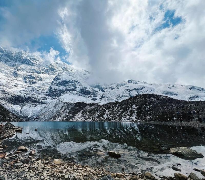
Urubamba is the largest town in the Sacred Valley, about an hour by road from Cusco, at 2,871 m (9,420 ft), some 530 m lower than the city. It is a market and farming town under the Chicón glacier and the valley's main base for hotels.

In this guide
The van comes down off the plateau in long curves, and the air changes before the view does. It gets softer, warmer, with a smell of wet earth and eucalyptus. Then the valley opens below you: a green floor of corn fields, a brown river cutting through it, and on the far side a wall of mountain capped with snow. That snow is Chicón. The town at its feet, with the orange bridge and the tin roofs shining in the sun, is Urubamba.
Short answer: Urubamba is the largest town in the Sacred Valley, about an hour by road from Cusco, at 2,871 m (9,420 ft), some 530 m (1,730 ft) lower than the city. It is a market and farming town under the Chicón glacier, and the valley's main base for hotels, with Ollantaytambo, Maras and Moray a short drive away.
Most visitors see Urubamba only from the window of a tour bus, on the way to lunch. That is a pity, because it is the most practical place in the valley to sleep. Here is what the town is, what it is good for and how to fit it into your trip.
Urubamba at a glance
Urubamba is the capital of the province of the same name in the Cusco region, in the middle of the Sacred Valley between Pisac and Ollantaytambo. The name also belongs to the river that runs past it, which you will follow by train all the way to Machu Picchu.
| Item | Detail |
|---|---|
| Location | Middle of the Sacred Valley, Cusco region, capital of Urubamba province |
| Drive from Cusco | About 1 hour by Chinchero |
| Altitude | About 2,871 m (9,420 ft), some 530 m lower than Cusco |
| Average high and low | 22.9°C (73°F) and 6.8°C (44°F), 1991 to 2020 averages |
| Rain | About 518 mm (20 in) a year, mostly December to March |
| Mountain above town | Chicón, with its glacier |
| Inca site in town | Quispiguanca, estate of Huayna Capac |
| Main festival | El Señor de Torrechayoc, first week of June |
Urubamba the town and Urubamba the river
The Urubamba River runs about 724 km (450 miles) from its source near the La Raya pass, southeast of Cusco, to the point where it joins the Tambo to form the Ucayali, a branch of the Amazon. Upstream it is called the Vilcanota. Through the Sacred Valley it is the Urubamba, and the town took its name.
When people search for Urubamba, Peru, they usually mean the town. When a train ticket or a rafting company says Urubamba, they mean the river. Both lead you to the same place.
What Urubamba is like
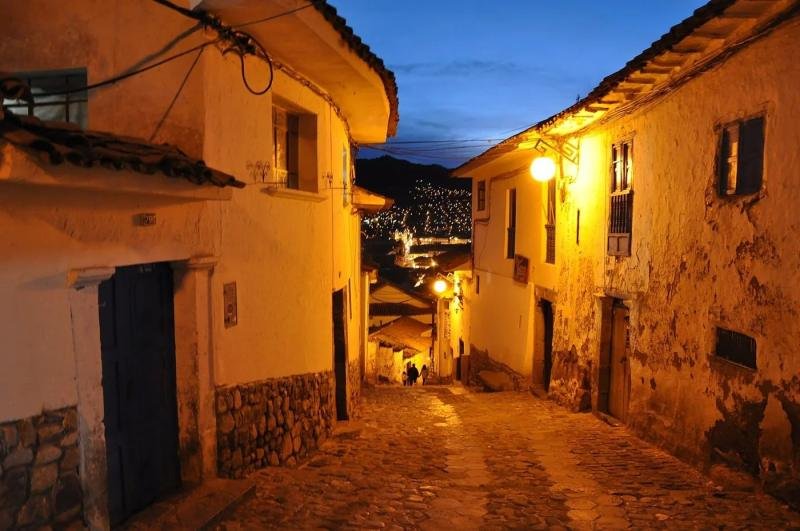
Urubamba is a working valley town, not a museum. The streets around the main square are lined with hardware stores, bakeries and mototaxis. The produce market sells corn, potatoes, fruit from the lower valleys and alpaca garments, and it is where people from the farming communities around the town do their shopping.
The weather is the reason many travelers end up here. The average daily high is 22.9°C (73°F) and the low is 6.8°C (44°F), according to the 1991 to 2020 averages cited by Wikipedia. Afternoons are warm enough for a T-shirt. Nights are cold, so a hotel with heating still matters.
Quispiguanca, the Inca estate in town
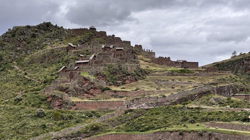
Before the Spanish arrived, this part of the valley was the royal estate of the Inca ruler Huayna Capac. His palace, Quispiguanca, stood on the northern side of today's town, at about 2,910 m. What survives is modest: a terrace, a long wall, gatehouses and some building outlines, standing among fields and a cemetery. Ask your guide to stop if you are interested. Most tours do not.
Festivals
The biggest local festival is El Señor de Torrechayoc, held in the first week of June, with processions and dancers in the streets. If your dates fall on it, expect a full town and music late into the night.
Why sleep in Urubamba
Urubamba is our pick for a first night in Peru's highlands when you fly into Cusco. You drop about 530 m below the city, which makes the first night easier on the body, and the CDC advises against raising your sleeping altitude too fast once you are above 3,000 m (9,840 ft). Read our guide to Sacred Valley altitude for the full comparison of towns.
The town also has the widest choice of hotels in the valley, many of them with gardens and space to rest, along the road toward Yucay and on the river. Our list of the best Sacred Valley hotels, ranked by public guest scores, includes several in and around Urubamba.
Urubamba or Ollantaytambo?
Sleep in Ollantaytambo the night before your Machu Picchu train, because the station is there and the early trains leave before 7 a.m. Sleep in Urubamba for comfort and space, or if you plan to spend a full day on Maras, Moray and Chinchero. The two towns are about 80 m apart in altitude, so choose by hotel and logistics, not by the thin air.
Things to do from Urubamba
Urubamba sits in the middle of the valley, which puts most of its sights within an hour.
- Maras and Moray: the Inca circular terraces and the salt pans on the plateau above the town, the closest big sights. See our guide to Maras and Moray.
- Ollantaytambo: the Inca town and temple hill at the western end of the valley, with the train station. See the Ollantaytambo guide.
- Pisac: the ruins on the ridge and the market, at the eastern end of the valley. See the Pisac guide.
- Chinchero: the weaving town and colonial church on the plateau, on the road back to Cusco.
For the order to see them in, read our Sacred Valley guide, stop by stop.
How to get to Urubamba from Cusco
Urubamba is about an hour by road from Cusco through Chinchero, or a little longer by Pisac along the valley floor. Shared vans and buses leave Cusco through the day, and a taxi or a hotel transfer takes you door to door.
The easiest way to see the town on a short trip is a valley tour. Our Sacred Valley full-day tour starts at Pisac, stops in Urubamba for a buffet lunch and continues to Ollantaytambo and Chinchero, for US$127 per person with the partial Boleto Turístico and a bilingual guide. If you are going on to Machu Picchu, the Sacred Valley and Machu Picchu 2-day tour starts at US$627 and spends the night in the valley.
Related tours


Questions people ask
Is Urubamba worth visiting?
Yes, as a base more than as a sight. Urubamba is the largest town in the Sacred Valley, with the widest choice of hotels, warm afternoons and Maras, Moray, Ollantaytambo and Pisac within an hour. It has a lively market but few monuments, so plan to sleep there rather than tour it.
What is the altitude of Urubamba?
Urubamba sits at about 2,871 m (9,420 ft), some 530 m (1,730 ft) lower than Cusco at 3,399 m (11,152 ft). That makes it one of the easiest places in the region to spend your first night after flying in from Lima.
How far is Urubamba from Cusco?
About an hour by road through Chinchero, or a little longer along the valley floor through Pisac. Shared vans and buses run through the day, and hotels in the valley can arrange a transfer from Cusco airport.
Is it better to stay in Urubamba or Ollantaytambo?
Stay in Ollantaytambo the night before an early Machu Picchu train, since the station is there. Stay in Urubamba for more hotel choice, gardens and space, and for easy day trips to Maras and Moray. The altitude difference between them is only about 80 m.
Is the Urubamba River the same river as at Machu Picchu?
Yes. The Urubamba runs through the Sacred Valley and past the foot of Machu Picchu, and the train follows it from Ollantaytambo to Aguas Calientes. Upstream, southeast of Cusco, the same river is called the Vilcanota.
Sources
- Wikipedia, Urubamba, Peru (altitude, Chicón, climate 1991 to 2020, Quispiguanca, festival, market) checked October 2026
- Wikipedia, Urubamba River (724 km, source near La Raya, Vilcanota, joins the Tambo to form the Ucayali) checked October 2026
- Wikipedia, Quispiguanca (estate of Huayna Capac, 2,910 m, remains) checked October 2026
- CDC Yellow Book, High Altitude Travel and Altitude Illness checked October 2026
This guide was last reviewed in October 2026. Prices, rules and timetables are quoted with the date we checked them.