


Huayna Picchu or Machu Picchu Mountain: Which Hike to Book
Huayna Picchu (route 3-A) is the steep peak behind the classic view, about an hour up on narrow, exposed Inca stairs. Machu Picchu Mountain (route 1-A) is higher and longer but wider and calmer. Huchuy Picchu (route 3-D) is a short climb. Pick by your fear of heights, then book early.

In this guide
Short answer: Huayna Picchu (route 3-A) is the steep peak behind the classic photo, about an hour up on narrow Inca stairs with real drops. Machu Picchu Mountain (route 1-A) climbs about twice as high on a wider path, with fewer people and a longer day. Huchuy Picchu (route 3-D) is a short climb for a taste of the view. Pick by your fear of heights, then book early.
All three are side trails off the Inca city, sold as their own routes on the official ticket site of the Ministerio de Cultura. You cannot add one to a ticket you already hold. You buy the mountain route instead of a plain circuit ticket, and it comes with two times: your entry hour at the main gate and your climbing hour at the mountain checkpoint. Our guide to buying Machu Picchu tickets walks through that purchase.
The three summits side by side
Huayna Picchu is the steepest and most exposed, Machu Picchu Mountain is the highest and longest, and Huchuy Picchu is the shortest. The table compares route codes, time allowed, height and effort. The time limits come from the Ministerio de Cultura's route maps. Summit heights are the figures most often published, since the official maps do not print them.
| Summit | Route | Max time inside | Summit height, ft (m) | Above the city | Climb up | Difficulty | Season |
|---|---|---|---|---|---|---|---|
| Huayna Picchu (Waynapicchu) | 3-A, Circuit 3 | 6 hours | About 8,835 (2,693) | About 850 ft (260 m) | About 1 hour | Steep, narrow, exposed | All year |
| Machu Picchu Mountain | 1-A, Circuit 1 | 7 hours | About 10,040 (3,061) | About 2,000 ft (630 m) | 1.5 to 2 hours | Long and steady, wide path | All year |
| Huchuy Picchu | 3-D, Circuit 3 | 3 hours 30 minutes | About 8,190 (2,497) | A few hundred feet | 20 to 30 minutes | Short and steep | High season only |
Here is how we steer people. If narrow stairs over a drop make your palms sweat, book Machu Picchu Mountain. If you want the peak you see in every photo and heights do not bother you, book Huayna Picchu. If you have little time, less fitness or a child with you, Huchuy Picchu gives you a summit in a fraction of the effort, in high season.
Huayna Picchu
Huayna Picchu (Waynapicchu on the official site) is the sharp peak that rises behind the city in the classic view. Its summit stands at about 8,835 ft (2,693 m), roughly 850 ft (260 m) above the city, and the climb takes about an hour, per PromPerú, Peru's tourism board. The ticket is route 3-A, part of Circuit 3, with up to 6 hours inside.
The trail is an Inca stairway cut into the rock. The steps are narrow and uneven, some are as tall as your knee, and on the steepest stretches steel cables are fixed to the rock to hold on to. Near the top you pass Inca terraces and buildings, squeeze through a short gap between boulders, and come out on a jumble of granite above the city. On the way down, a few sections of stairs drop straight off the slope.
Is it scary? For most people, the climb is hard work and the descent is the scary part. Nothing is technical and you need no gear, but the exposure is real, and people with vertigo freeze on the upper stairs every season. Go up slowly, keep three points of contact on the steep steps, and come down facing the slope where it feels steep.
On the way to the checkpoint, route 3-A crosses the lower half of the city: the Temple of the Condor, the water mirrors, the Twelve Doorways and the eastern storehouses, then the Sacred Rock, where the trail starts. You do not walk the classic Circuit 2 path through the Plaza of the Temples on this ticket.
Machu Picchu Mountain
Machu Picchu Mountain (Montaña Machupicchu, route 1-A) is the big peak on the opposite side of the city from Huayna Picchu. Its summit is usually given as about 10,040 ft (3,061 m), which is roughly 2,000 ft (some 630 m) above the city, and the route allows 7 hours inside, the longest of any route.
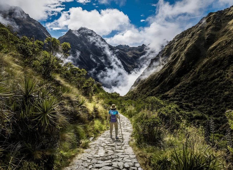
The path is a wide Inca stairway that climbs steadily through cloud forest. Most fit hikers reach the top in 1.5 to 2 hours and come down in about an hour. It is the harder workout of the two big summits, with twice the height gain, but the path is broad, the drops are mostly behind low walls or trees, and the summit is a flat platform with a sign and room to sit.
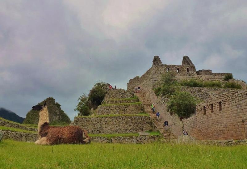
The reward is the view down onto the whole site, with Huayna Picchu looking small and the Urubamba River curling around both. You also start on the upper terraces of Circuit 1, which means the highest postcard angle of the city is on your way. The trade-off: route 1-A never walks through the city itself. Plenty of people pair it with a Circuit 2 ticket at another hour so they see the temples too. Our guide to the circuits and routes explains how that works.
Huchuy Picchu
Huchuy Picchu (route 3-D) is the small hill next to Huayna Picchu, at about 8,190 ft (2,497 m) per published guides, only a few hundred feet above the city. The climb up takes 20 to 30 minutes on steep stone steps, and the route allows 3 hours 30 minutes inside. It is sold only in high season.
From the top you look back at the city from the north, with Huayna Picchu towering beside you instead of in front. Few people book it, so the trail is quiet. We suggest it to travelers who want one climb in the day without committing half of it, to families with older kids, and to anyone who finds Huayna Picchu sold out.
Booking the mountains
Huayna Picchu sells out first of all Machu Picchu routes, because each mountain has a small daily quota and tour operators reserve the morning hours for the season ahead. Book route 3-A the day your travel dates are firm. For June to August, that means three months ahead or more, by our own booking experience. Machu Picchu Mountain lasts a little longer, and Huchuy Picchu usually has space.
Mountain routes cost more than a plain circuit ticket. Check the price in force on tuboleto.cultura.pe before paying. The climbing hour on your ticket is strict: the mountain checkpoints for Machu Picchu Mountain, Huayna Picchu and Huchuy Picchu give no tolerance at all, per the Ministerio de Cultura's entry-hours table. Arrive late and you visit the city only.
Do not plan a mountain on a day trip from Cusco. The first trains reach Aguas Calientes in mid-morning, and a summit plus the bus and the return train does not fit in the hours left. Sleep in Aguas Calientes, take an early entry, and climb while the air is cool. In the rainy months, roughly November to March, the stairs are slick and Machu Picchu Mountain often sits in cloud, so pick Huayna Picchu or Huchuy Picchu then, or accept that the view is a gamble.
If you would rather not chase quotas and timetables, we can add Huayna Picchu to a Machu Picchu tour with a night in Aguas Calientes, so the climb, the train and the guided visit line up.
Questions people ask
Which is harder, Huayna Picchu or Machu Picchu Mountain?
Machu Picchu Mountain is the harder workout: about 2,000 ft of climbing, 1.5 to 2 hours up on a wide stairway. Huayna Picchu is shorter, about an hour and 850 ft, but steeper, narrower and far more exposed. People who are fit but afraid of heights find Machu Picchu Mountain easier. People short of breath find Huayna Picchu easier.
How many steps are there on Huayna Picchu?
There is no official count, and the numbers published by tour sites vary widely. Judge it by height instead: the summit is about 850 ft (260 m) above the city, climbed in about an hour on narrow Inca stone steps, some knee-high. Expect to stop often on the upper section, where steel cables help on the steepest stairs.
Is Huayna Picchu scary?
For anyone uneasy with heights, yes, in places. The trail has narrow stairs with open drops, steel cables on the steepest parts and a descent that some people take sitting down. It is not technical climbing and needs no gear. If a glass elevator bothers you, book Machu Picchu Mountain or Huchuy Picchu instead.
How early should you book Huayna Picchu tickets?
Huayna Picchu is the first Machu Picchu route to sell out, especially the morning climbing hours. For June to August we book it three months ahead or more, and one to two months ahead in the shoulder months, based on our own bookings. Check live spaces on the official availability page at tuboleto.cultura.pe before you fix your train.
Does a Huayna Picchu ticket include the Machu Picchu citadel?
Yes, part of it. Route 3-A crosses the lower half of the city, including the Temple of the Condor and the Sacred Rock, on the way to the mountain checkpoint. It does not follow the Circuit 2 path through the Plaza of the Temples. For the full city as well, buy a Circuit 2 ticket for another hour.
What is Huchuy Picchu?
Huchuy Picchu is the small hill beside Huayna Picchu, sold as route 3-D in high season only. The climb takes 20 to 30 minutes on steep steps and the route allows 3 hours 30 minutes inside. It gives a view back over the city from the north and suits travelers who want a short summit or find Huayna Picchu sold out.
Sources
- machupicchu.gob.pe, Circuits and routes (RM 528-2023-MC) checked October 2026
- Ministerio de Cultura, route map 3-A, Waynapicchu (PDF) checked October 2026
- Ministerio de Cultura, route map 1-A, Machu Picchu Mountain (PDF) checked October 2026
- Ministerio de Cultura, route map 3-D, Huchuypicchu (PDF) checked October 2026
- Ministerio de Cultura, DDC Cusco, Horarios de ingreso (no tolerance at mountain checkpoints, PDF) checked October 2026
- Ministerio de Cultura, live availability per route and hour checked October 2026
- PromPerú (peru.info), Huayna Picchu: Cusco's young mountain checked October 2026
- Wikipedia, Huayna Picchu (height, cables, descent) checked October 2026
This guide was last reviewed in October 2026. Prices, rules and timetables are quoted with the date we checked them.