


Choquequirao: The Inca Site You Reach Only on Foot
Choquequirao is an Inca city at about 10,010 ft (3,050 m) on a ridge above the Apurímac canyon, reached by two days of walking from Cachora, four hours by road west of Cusco. Only 30 to 40 percent is excavated, there is no road or train, and the cable car is announced, not built.

In this guide
Short answer: Choquequirao is an Inca city at about 10,010 ft (3,050 m) on a ridge above the Apurímac River canyon, about four hours by road west of Cusco to the trailhead at Cachora and then two days of walking in and two days out. It covers about 1,800 hectares (4,450 acres), and only 30 to 40 percent has been excavated. There is no road, no train and no cable car yet, which is why you may share it with a handful of people on a day when Machu Picchu holds thousands.
What stands at Choquequirao
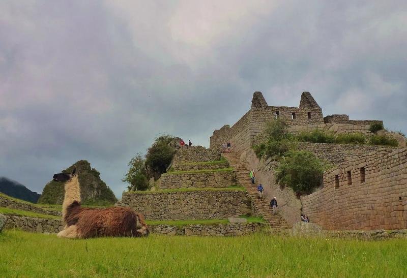
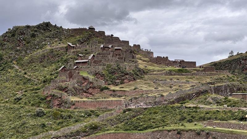
The name is usually translated as Cradle of Gold, from the Quechua and Aymara words choqe (gold) and k'iraw (cradle). The site was most likely founded under the Inca ruler Pachacuti and enlarged by his son Tupac Inca Yupanqui, and the style of some buildings points to Chachapoya workers brought from the north. People call it the sister of Machu Picchu because the layout matches: a central plaza on a leveled ridge, temples and halls around it, terraces falling away on every side, water channels running through the lot. It is larger than Machu Picchu in area and far less excavated.
What you walk through on a visit: the main plaza with its long halls (kallankas), the truncated hilltop platform (ushnu) flattened for ceremonies, a residential sector, the temples, ritual baths, and terrace after terrace stepping down toward the river. The thing nobody forgets is Sector VIII, where white stones set into the terrace walls form 25 figures of llamas, 4 to 6 ft (1.25 to 1.94 m) tall, walking uphill in a line. The side trail to the llama terraces is steep and takes an extra hour or two. Ask your guide for it on the morning of day 3. Most groups that skip it regret it.
The site sits in the Santa Teresa district of La Convención province, Cusco region, on the north side of the canyon, with the river about 5,250 ft (1,600 m) below. Clouds roll up from the Apurímac in the afternoon and the terraces disappear and reappear. Bring your camera to breakfast.
The hike
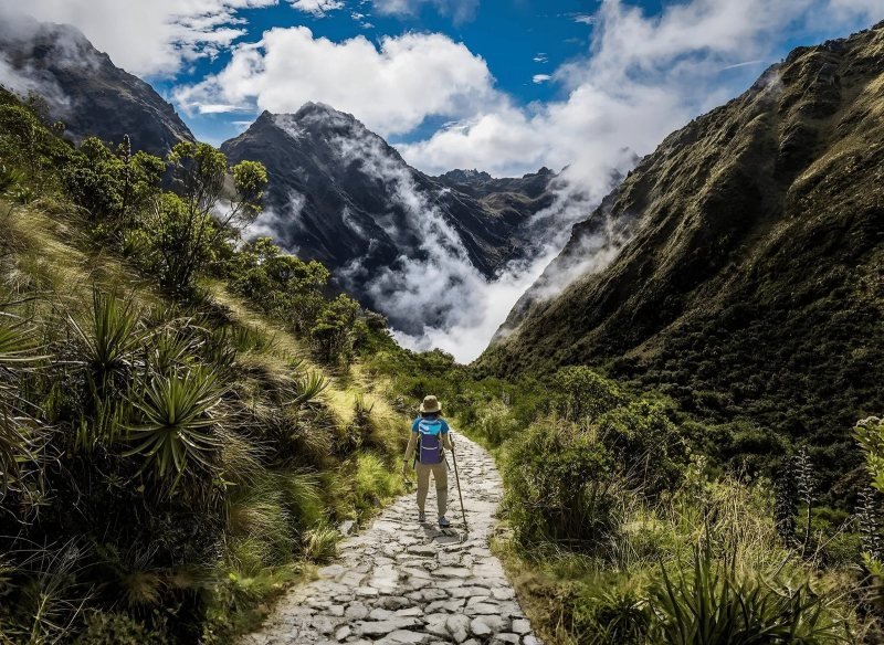
There is one standard way in, and it is the same way out. You drive about four hours west from Cusco through Cachora to the trailhead at Capuliyoc, a viewpoint at about 9,560 ft (2,915 m) with the canyon spread below. Then you descend about 4,640 ft (1,415 m) on dusty switchbacks to a camp at Chiquisca, about 4,920 ft (1,500 m), where the air is warm and thick. Day 2 starts before the sun reaches the slope: down to the bridge over the Apurímac, then the long climb up the far wall through Marampata to the site, more than 5,000 ft (about 1,550 m) of gain, mostly in heat and with little shade. Day 3 is the morning inside the site and the walk back down into the canyon. Day 4 is the climb back out to Capuliyoc and the drive to Cusco, arriving between 6 and 7 p.m.
The numbers that matter are the vertical ones. The route never goes above 10,010 ft (3,050 m), lower than Cusco at 11,150 ft (3,400 m), so altitude illness is rare here. The difficulty is two climbs of 4,600 to 5,000 ft (1,400 to 1,550 m) in canyon heat, plus the descents that come before them. Our guides rate it the hardest trek we run, harder than the Inca Trail or Salkantay, even though both of those go higher. The total walking is about 38 mi (62 km) over four days, roughly 6 to 8 hours a day.
What makes it manageable: a cook, support staff and pack animals carry the camp and your duffel, so you walk with a daypack. Water and snacks are sold at Chiquisca and Marampata by the families who farm there, in cash. Trekking poles are not optional, and neither are 3 liters of water on the climbing days, electrolytes, a sun hat and long sleeves. Train with 4,000-ft days on hills or stairs at home. If you want a trek that ends at Machu Picchu, this is not it: book the Salkantay trek 5 days instead, or read our comparison of the best treks from Cusco. If an Inca city almost to yourself is the point, our Choquequirao trek 4 days includes the guide, cook, pack animals, camping gear and the entrance, for US$767 per person.
Longer routes exist that continue from Choquequirao over the mountains to Machu Picchu in 7 to 9 days, and some hikers take a saddle horse for the climbs. Ask us for a quote if either interests you, and we will tell you plainly what we can and cannot arrange.
Entry, the cable car and when it is open
Choquequirao has no permit system and no daily quota. You pay an entrance fee at the checkpoint before the site, with reduced rates for students, and our trek price includes it. The amount changes, so we leave it off this page and put it in the trip's inclusions.
The cable car has been announced for more than a decade. The project, run through Peru's investment promotion agency ProInversión as a public-private partnership, would carry visitors across the canyon in about 20 minutes and is budgeted at US$441.57 million. As of April 2026, five bidders had bought the right to take part and the award was expected by the end of that year, per the business daily Gestión. Nothing has been built. Until a cabin actually crosses the Apurímac, the only way in is the one described above, and that is the reason to go now rather than after.
The access trail from Cachora closed for more than two months in early 2026 after heavy rains weakened it, and reopened in the week of April 22, 2026 after maintenance, according to operator reports. Expect the same kind of closure in a very wet year. Check with your operator in the weeks before a rainy-season departure.
Best months for Choquequirao
May to October. The dry season in the Cusco region runs from May to September per Peru's weather service SENAMHI, and the trail is firm and the canyon views clear through October. The trade-off is heat: the canyon floor gets hot by midday in every dry month, which is why the climbs start before dawn. June and July bring the clearest skies and cool nights at the site, where you sleep near 10,000 ft and want a fleece.
From December to March the rains are heaviest. The switchbacks turn to mud, rocks come down on the trail, the river runs high and brown, and closures like the one in early 2026 happen. April and November are the shoulder months: greener, fewer people, some afternoon showers. If those are your dates, go, but keep a spare day in Cusco in case the trail closes.
Choquequirao or Machu Picchu
Both, in that order, if you have the legs and the days. They are not the same experience. Machu Picchu is finished, restored and busy, with timed tickets and marked circuits, and the view from the Sun Gate is the one everybody wants. Choquequirao is two thirds buried, has no ticket queue and no circuit, and you may walk the main plaza alone at sunrise while the clouds lift off the terraces. If you must pick one and you are not a hiker, Machu Picchu. If you have done Machu Picchu and want to feel what Hiram Bingham felt, Choquequirao.
| Fact | Value | Source |
|---|---|---|
| Altitude of the site | about 10,010 ft (3,050 m) | en.wikipedia.org |
| Location | Santa Teresa district, La Convención province, Cusco region, above the Apurímac canyon | en.wikipedia.org |
| Area and excavation | about 1,800 hectares (4,450 acres), 30 to 40 percent excavated | en.wikipedia.org |
| Trailhead | Capuliyoc near Cachora, about 9,560 ft (2,915 m), about 4 hours by road from Cusco | |
| Low point | Chiquisca camp about 4,920 ft (1,500 m), river crossing about 4,760 ft (1,450 m) | en.wikipedia.org |
| Trek | 4 days, 3 nights in tents, about 38 mi (62 km), very demanding | |
| Permit | none, entrance fee paid at the checkpoint (included in our trek) | explorandes.com |
| Cable car project | announced, not built: ProInversión tender, US$441.57 million, award expected late 2026 (as of April 2026) | gestion.pe |
| Best months | May to October | senamhi.gob.pe |
| Our trek | US$767 per person, guide, cook, pack animals, camping and entrance |
Sources
- Choquequirao, Wikipedia (altitude, area, percentage excavated, name, builders, llama terraces, Cachora route)
- Gestión, Teleférico de Choquequirao: project status, investment and bidders (April 22, 2026)
- Operator report on the 2026 trail closure and reopening (April 22, 2026)
- Operator guide on Choquequirao fees and permits (no quota, fee paid at the checkpoint)
- SENAMHI, climate of the Cusco region (rainy and dry seasons)
Questions people ask
How do you get to Choquequirao?
On foot only. Drive about four hours west from Cusco to Cachora and the Capuliyoc trailhead, then walk two days: down about 4,640 ft (1,415 m) to the Apurímac, across the bridge and up more than 5,000 ft (1,550 m) to the site. You walk out the same way, so the standard trek is four days. There is no road, train or cable car.
Is there a cable car to Choquequirao?
Not yet. A cable car across the canyon has been planned for years and is in a ProInversión tender budgeted at US$441.57 million, with the award expected late in 2026 (as of April 2026, per Gestión). Nothing is built. For now the only way to the site is the two-day walk from Cachora.
How hard is the Choquequirao trek?
Very hard, and the hardest trek we run. The altitude is low, never above 10,010 ft (3,050 m), but the route drops into a hot canyon and climbs out of it twice, with gains of 4,600 to 5,000 ft (1,400 to 1,550 m) on days 2 and 4. Train with big hill days, bring poles, and carry 3 liters of water on the climbs.
How high is Choquequirao?
The site is at about 10,010 ft (3,050 m), lower than Cusco at 11,150 ft (3,400 m). The trailhead at Capuliyoc is about 9,560 ft (2,915 m) and the camp at Chiquisca about 4,920 ft (1,500 m), near the river. Altitude sickness is rare on this trek. Heat is the problem.
Can you combine Choquequirao with Machu Picchu?
Yes, two ways. Do the 4-day Choquequirao trek, rest a day in Cusco, then take the train to Machu Picchu. Or walk the long route that continues from Choquequirao over the mountains to Machu Picchu in 7 to 9 days, which some operators run. Ask us for a quote on the long route and we will say plainly whether we can arrange it.
How many people visit Choquequirao?
A small fraction of Machu Picchu's visitors, because everyone arrives on foot. On most days you share the site with a few groups, and at sunrise you may have the main plaza to yourself. That stays true until a cable car is built, which is the reason we tell hikers to go before it opens.
This guide was last reviewed in October 2026. Prices, rules and timetables are quoted with the date we checked them.